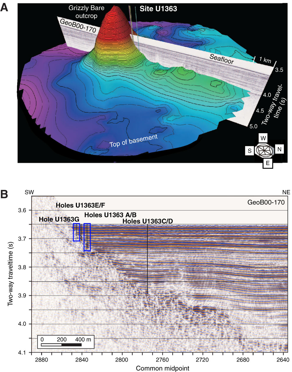
Figure F2. A. Three-dimensional perspective views of basement relief around Site U1363 adjacent to Grizzly Bare outcrop. Bathymetry based on digitization of seismic lines across work areas (data from Rosenberger et al., 2000; Zühlsdorff et al., 2005; Hutnak et al., 2006). Relief is shown as two-way traveltime, with no conversion to sediment thickness or depth. Part of Line GeoB00-170 (as shown in Figure F1C) is overlaid here to approximate sediment thickness (modified from Expedition 327 Scientists, 2011a). B. Seismic Line GeoB00-170 across Holes U1363A–U1363G. The sediment/basalt interface is clearly visible, but internal structure of the Grizzly Bare edifice is less resolved. Blue boxes indicate the locations of Holes U1363G and U1363B, which are shown in C (modified from Expedition 327 Scientists, 2011c). (Continued on next page.)
Previous | Close | Next | Top of page