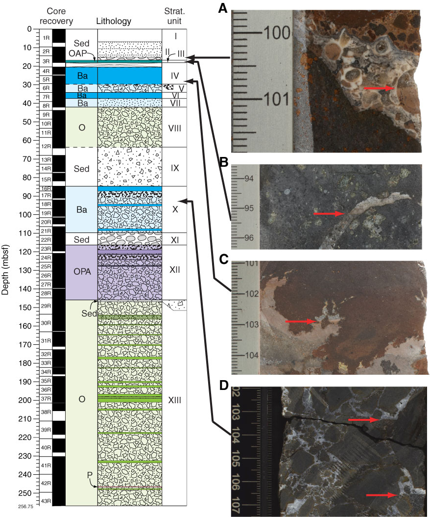
Figure F53. Representative close-up photographs of geopetal structures and their stratigraphic positions in the upper half of Hole U1374A. A. Geopetal within a fossil, with the lower portion filled by pink micrite and the upper portion filled by clear calcite (interval 330-U1374A-3R-1A, 99.7–101.8 cm [wet]). B. Fracture in the uppermost lava flow, with the base filled by dark sandy sediments and the upper portion filled by lighter sediments (interval 3R-2A, 93.5–96.4 cm [dry]). C. Peperitic lava, with the lower portion of the geopetal filled with pink sediments and the upper half with calcite (interval 5R-4A, 101–104.6 cm [dry]). D. Fractures in breccia, with the lower portion filled with dark sand-size sediments and the top filled with calcite (interval 18R-1A, 102–107.5 cm [dry]). In all cases the geopetal structures are still in their original horizontal sedimentary position, indicating that no tilting of these rocks occurred since deposition. For explanation of lithology symbols and patterns, see Figure F18.

Previous | Close | Next | Top of page