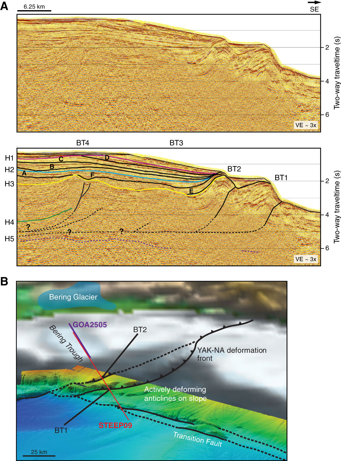
Figure F10. A. STEEP09 seismic line, uninterpreted (top) and interpreted (bottom), showing mappable horizons through the Bering Glacier shelf region. Targets for Site U1420 include Horizon H1, locally an angular unconformity at the base of glacial erosion surfaces, and Horizon H2, which marks the cessation of movement on the Pamplona Zone structures beneath the Bering Trough. Colored lines (H1–H5) are regional horizons interpreted throughout the study area. Black horizons (A–F) are interpreted locally to define glacial depositional sequences in the upper 2 s of the record. VE = vertical exaggeration assuming 1500 m/s sound velocity. BT1–BT4 = fault structures. B. Perspective view of the Bering Trough region, showing locations of the trough relative to active structures of the Pamplona Zone. YAK-NA = Yakutat-North America. Modified from Worthington et al. (2010).
Previous | Close | Next | Top of page