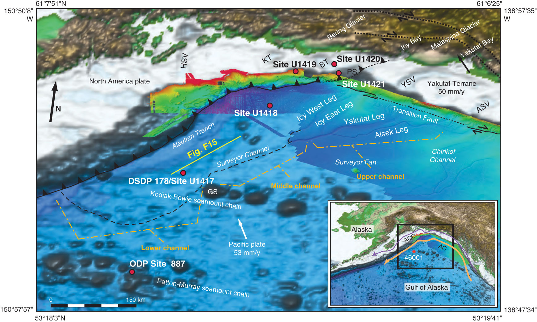
Figure F6. 3-D perspective view of the bathymetry/topography of the southern Alaska continental margin, showing tectonic boundaries and the Surveyor Fan in high-resolution bathymetry. HSV = Hinchinbrook Sea Valley, ASV = Alsek Sea Valley, BT = Bering Trough, GS = Giacomini Seamount, KT = Kayak Trough, PS = Pamplona Spur, YSV = Yakutat Sea Valley. Plate boundaries adapted from Gulick et al. (2007). High-resolution bathymetry from Gardner et al. (2006). Remaining bathymetry from Smith and Sandwell (1997). Yakutat Terrane motion relative to North America from Elliott et al. (2010). Pacific plate motion from Kreemer et al. (2003). Inset: Location of Alaska Coastal Current (ACC; purple), Alaska Current (AC; orange), and NOAA wave buoy 46001 (red star). Modified from Reece et al. (2013).

Previous | Close | Next | Top of page