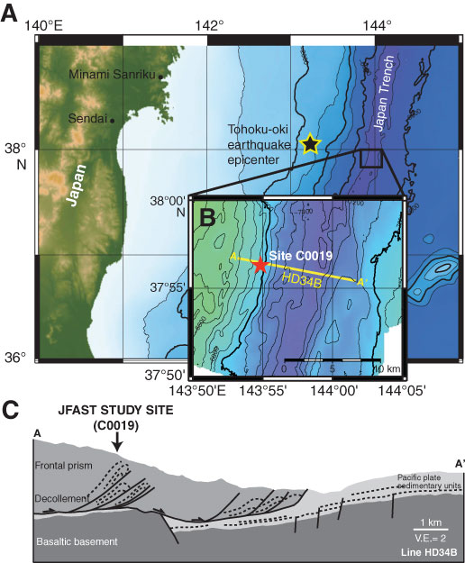
Figure F1. A. Location map showing Tohoku area of the Japan Trench and Tohoku-oki earthquake epicenter. B. Location of Site C0019 and orientation of in-line seismic section Line HD34B (Nakamura et al., 2013) (500 m north of Site C0019) (modified after Fig. F1 in the “Expedition 343/343T summary” chapter [Expedition 343/343T Scientists, 2013a]). C. Cross section (A to A′) through the toe of the Japan Trench prism with location of Site C0019 and plate boundary décollement showing overall margin architecture (V.E. = vertical exaggeration) (modified after Kirkpatrick et al., 2015).
Close | Next | Top of page