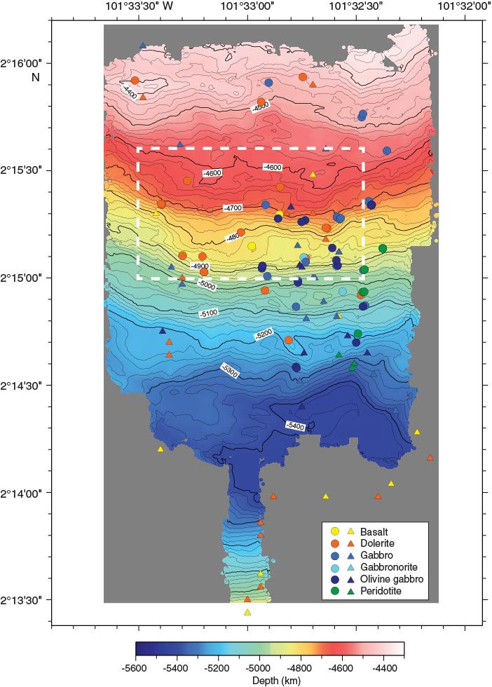
Figure F7. Contoured microbathymetry map for the southern slope of the intrarift ridge between 4300 and 5400 mbsl showing the location and rock type of samples recovered during the JC21 site survey cruise by the ROV Isis (circles; MacLeod et al., unpubl. data) and the submersible Nautile during the NazCoPac cruise (triangles; Francheteau et al., 1990). Rock types were determined by shore-based petrographic analysis (MacLeod, pers. comm., 2009; Hékinian et al., 1993). Microbathymetry data were acquired at a nominal altitude of ~100 m and speed of 0.3 kt by a Simrad SM2000 (200 kHz) multibeam sonar system mounted on the Isis. Swath widths during Isis surveys were ~200–350 m depending on noise and seabed characteristics (dip and reflectivity). See Figure F6 for location within the Hess Deep Rift. The dashed line outlines the area surrounding Site U1415 shown in Figure F17. Note that the NazCoPac samples are not precisely located, as the dive tracks were not transponder navigated. Map prepared by D. Shillington and V. Ferrini. Contour interval = 20 m.
Previous | Close | Next | Top of page