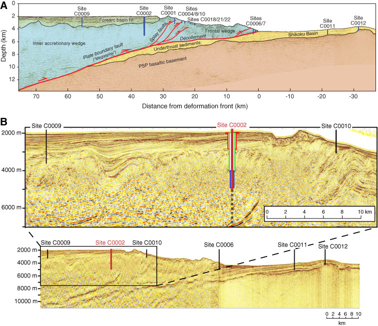
Figure F2. Seismic reflection depth sections with tectonic interpretation and selected NanTroSEIZE drill sites. A. Deep penetration depth section Line 5 (Park et al., 2002), reinterpreted in light of more recent geophysical imaging. B. Upper panel: expanded scale image of the region around Holes C0002F, C0002N, and C0002P. The heavy solid red line represents the currently drilled borehole, and the dashed line shows the projected extension to the plate boundary fault target. The boxes represent cased sections of Holes C0002F, C0002N, and C0002P (red shows the 36 and 20 inch casing, green represents the 13⅜ inch casing, and blue indicates the 11¾ inch casing liner section. Lower panel: composite seismic depth section of the NanTroSEIZE site and related drilling sites from the Kumano Basin (Site C0009) to the input sites (C0011 and C0012).
Previous | Close | Next | Top of page