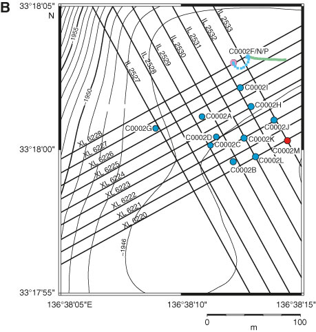
Figure F1 (continued). B. Bathymetric map showing all Site C0002 holes. The long-term borehole monitoring system is installed in Hole C0002G, and the riser hole is Hole C0002F/C0002N/C0002P. The lines from Hole C0002F show the azimuth and deflection of Holes C0002N (blue dashed line) and C0002P (green line) from the original Hole C0002F borehole.
Previous | Close | Next | Top of page