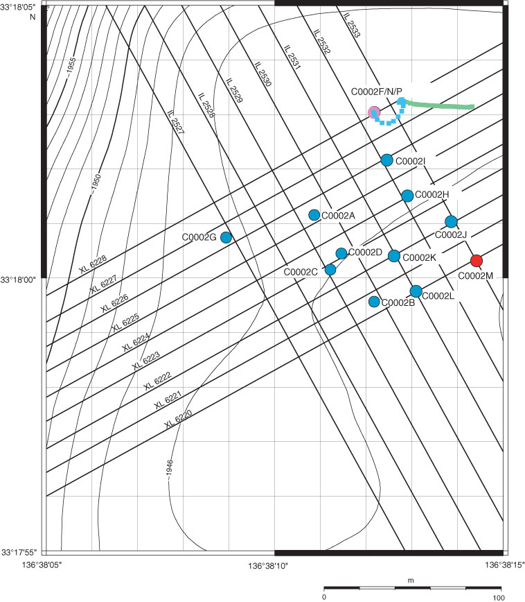
Figure F3. Bathymetric map of all holes drilled at Site C0002. Holes C0002M (red circle), C0002N (blue dashed line), and C0002P (green dashed line) were drilled during Expedition 348. Contours in meters below sea level.
Previous | Close | Next | Top of page