Next Section | Table of Contents
doi:10.2204/iodp.sp.301.2004
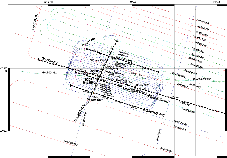
Figure F4. Detailed track chart showing area around ODP Sites 1026 and 1027 and IODP SR sites, including multichannel SO149 seismic data acquired in 2000. Spacing of seismic lines over the buried basement ridge comprising the primary target for drilling is 100 m within 1 km north and south of Hole 1026B. Expedition 301 will replace Cork observatories in Holes 1026B and 1027C and drill and emplace new observatories at Site SR-1. Work will be done at Site SR-2 during a subsequent expedition. Thick dashed lines show locations of seismic Lines GeoB 00-203 (Sites 1026 and 1027; Fig. F3D), GeoB 00-466 (Site SR-1; Fig. F5), and GeoB 00-482 (Site SR-2; Fig. F6). Two additional line locations are shown: crossing Line GeoB 00-490 and Line GeoB 00-483, which defines the northernmost extent of the area of dense seismic coverage.