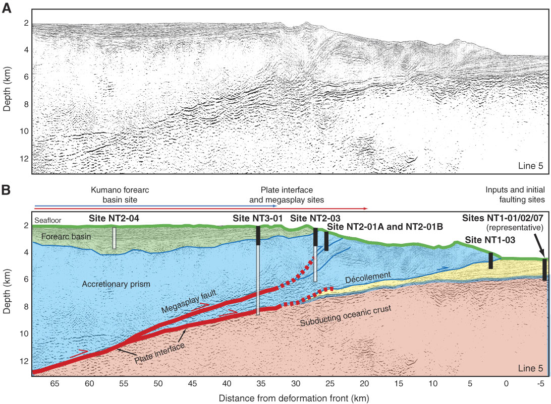
Figure F2. Line KR0108-5 (see Fig. F1B). A. Uninterpreted (prestack, depth migration) shows structure of Nankai Trough accretionary prism (from Park et al., 2002). B. Interpretation shows locations of Stage 1 sites slated for LWD, coring, and downhole measurement/CORK installation (after Tobin and Kinoshita, 2006). Solid rectangles = TD planned for Stage 1, open rectangles = TD planned for future operations. The extent of coseismic rupture in the 1944 Tonankai (M 8.2) great earthquake determined from tsunami (red arrows) (Tanioka and Satake, 2001) and seismic (blue arrows) (Kikuchi et al., 2003) waveform inversions are shown above the seismic lines.
Previous | Close | Next | Top of page