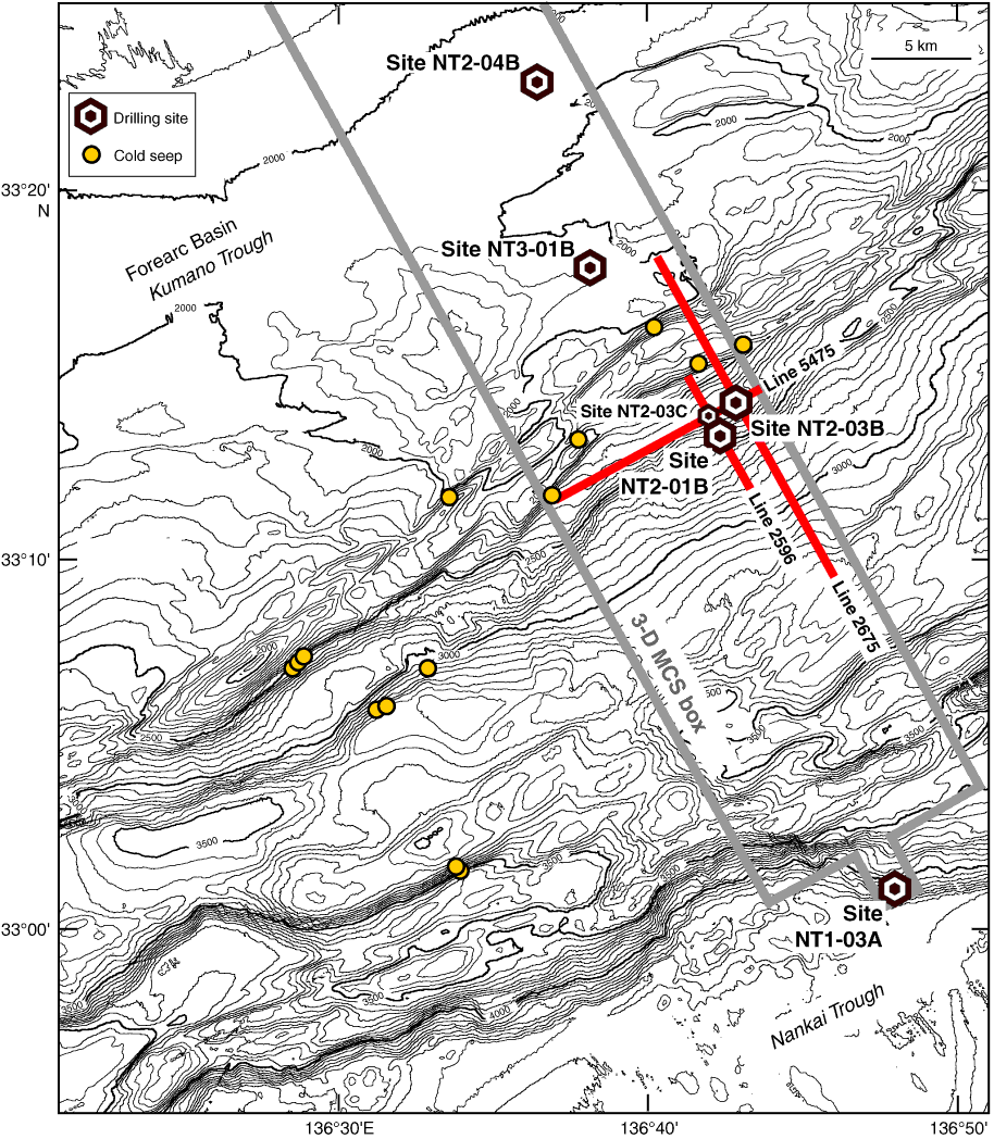
Figure F3. Bathymetric map of the Nankai accretionary prism off Kumano showing drill sites and cold seep locations as determined by Shinkai 6500 dives. Gray outline = three-dimensional (3-D) seismic survey area. Red lines = 3-D seismic tracks on which the drill sites of this expedition are located. Depths in meters are indicated by the numbers along their respective isoclines.
Previous | Close | Next | Top of page