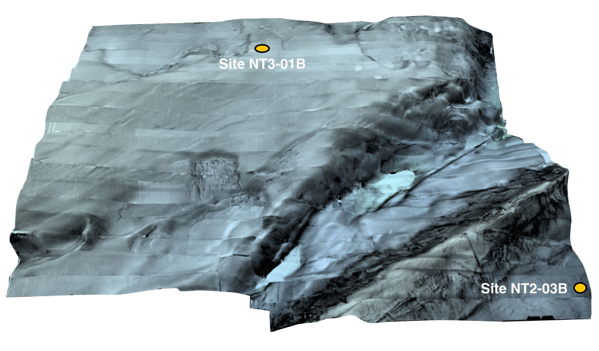
Figure F7. Three-dimensional side-scan image collected by deep-tow side-scan sonar Wadatsumi over Kumano Basin and forearc slope showing the roughness and steepness of the proposed drill sites. A north-northeast–south-southwest trending lineament is clearly observed in the depression between the outer ridge and the forearc basin. Aerial coverage is shown in Figure F8, which does not include sites in the trench or the reference sites on the Philippine Sea plate (proposed Sites NT1-03, NT1-04, NT1-02, and NT1-07).
Previous | Close | Next | Top of page