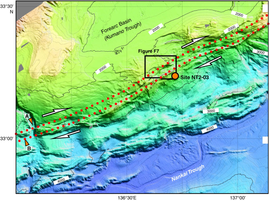
Figure F8. Bathymetric map showing the strike-slip fault zone (between red dotted lines). Shear sense is estimated to be dextral, based on the gap of the canyon axis (arrows A and B). Depth in meters is indicated by the numbers in white boxes along their respective isoclines.
Previous | Close | Next | Top of page