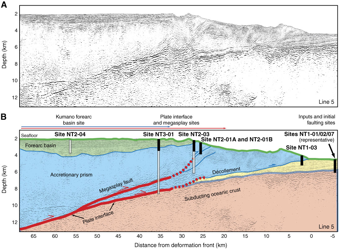
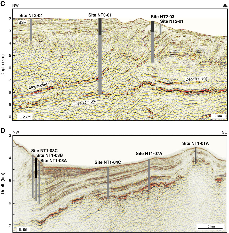
Figure F2. A. Uninterpreted seismic Line KR0108-5 (prestack, depth migration) showing the structure of the Nankai Trough accretionary prism in the area selected for drilling operations (from Park et al., 2002). Location of Line KR0108-5 is shown in Figure F1B. B. Interpretation of Line KR0108-5 showing locations of Stage 1 sites proposed for logging while drilling, coring, and downhole measurement/CORK installation, after Tobin and Kinoshita (2006b). Black rectangles = total depth planned for Stage 1, empty rectangles = planned total depth for future operations. The extent of coseismic rupture in the 1944 M 8.1 Tonankai great earthquake determined from tsunami (Tanioka and Satake, 2001) and seismic (Kikuchi et al., 2003) waveform inversions are shown above the seismic line by red and blue arrows, respectively. Drill sites (Fig. F1B) shown overlain on (C) uninterpreted depth migrated seismic three-dimensional Inline 2675 (vertical exaggeration [V.E.] = 2) and (D) IFREE Line 95 (V.E. = 4.6). Black rectangles = total depth planned for Stage 1, empty rectangles = planned total depth for future operations.
Previous | Close | Next | Top of page