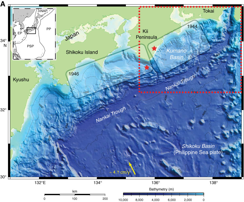
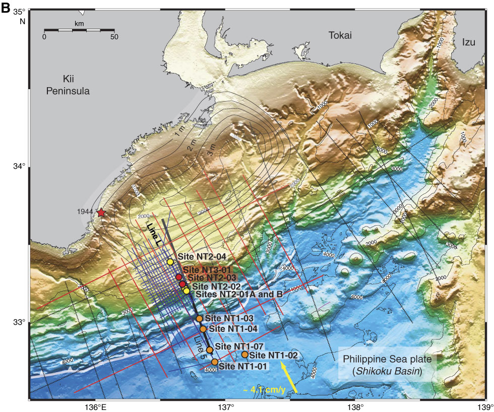
Figure F1. A. Nankai Trough off southwestern Japan is the locus of subduction of the Philippine Sea plate (PSP) beneath Honshu and Shikoku islands. Yellow arrow = convergence direction between PSP and Japan. Rupture zones of the last two great subduction earthquakes (1944 and 1946) are also shown. Stars = epicenter locations for earthquake nucleation. Red dashed line = Kumano Basin drilling area. In inset, EP = Eurasian plate, PP = Pacific plate, NAP = North American plate. B. Bathymetric map of Kumano Basin region, with all multichannel seismic profile locations and planned Stage 1 drill sites (primary and alternates). Expedition 316 will occupy proposed Sites NT1-03 and NT2-01. Portions of Line 5 and Line L (thick black line) shown in Figures F2 and F3, respectively. White barbed line = position of deformation front of accretionary prism, yellow arrow = convergence vector between Philippine Sea plate and Japanese Islands (Eurasian plate), red dots = planned future riser drilling sites, yellow and orange dots = riserless sites.)
Previous | Close | Next | Top of page