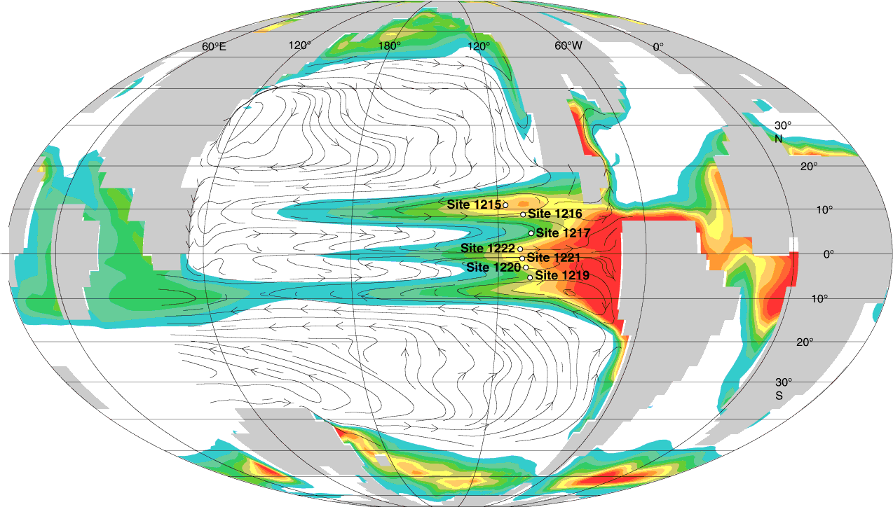
Figure F8. Model of early Eocene equatorial upwelling from Huber (2002), showing global land-sea distribution and annual average upwelling into the thermocline. Red = regions of vigorous upwelling, green to blue = regions of weak upwelling, white = areas of average downwelling. Current streamlines at ~100 m ocean depth are shown for the Pacific. All map views are projected on a Mollweide projection. The upwelling region in the eastern Pacific was broader than that of the modern region, primarily because of secondary upwelling centers on the edges of the region.
Previous | Close | Next | Top of page