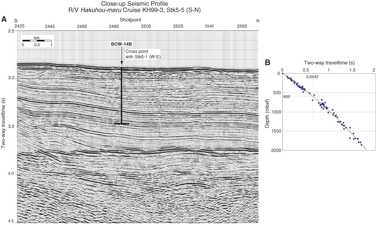
Figure AF16. A. Close-up seismic profile of Hakuhou-maru Cruise KH99-3 Line Stk5-5 (S–N) near Site BOW-14B (179°00.5´E, 54°02.0´N, Shotpoint 2488; water depth = 2166 m; penetration depth = 555 m coring). B. Time-depth curve estimated from results of velocity analyses on Lines Stk5-1 and Stk5-5 around Site BOW-14B.
Previous | Close | Next | Top of page