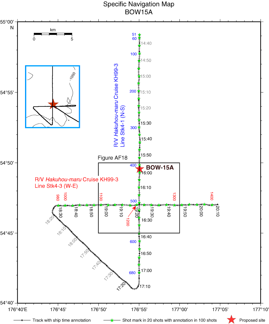
Figure AF17. Specific navigation map of Hakuhou-maru Cruise KH99-3 around Site BOW-15A with ship time and shotpoint annotation. Crossing of survey lines is at 19:21:35, Shotpoint 1203, on Line Stk4-3 (W–E) and 16:20:40, Shotpoint 505, on Line Stk4-1 (N–S). Site BOW-15A is located at 15:58:30, Shotpoint 410, on Line Stk4-1 (N–S). Squares = navigation map area for close-up seismic profiles in Figure AF18. Time annotation in black letters = range of subbottom profile survey in Figure AF23.
Previous | Close | Next | Top of page