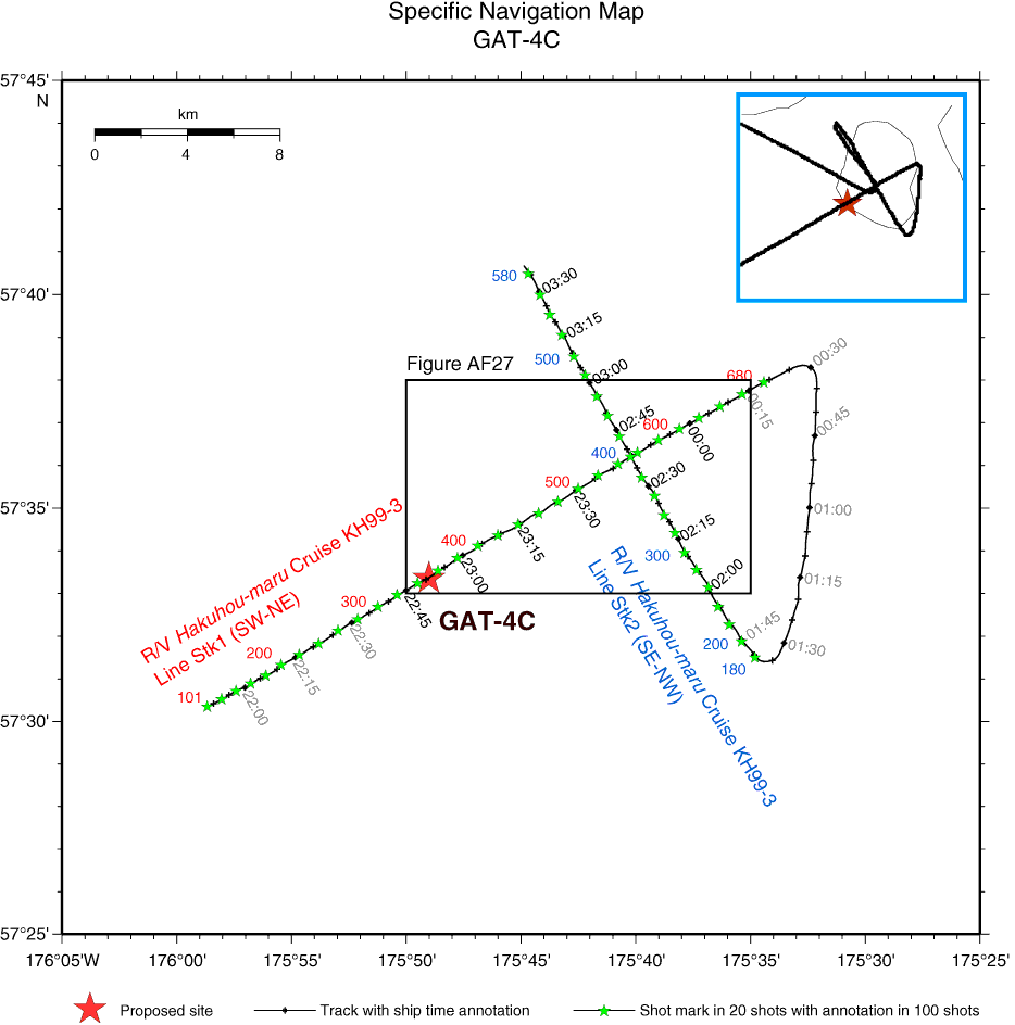
Figure AF26. Specific navigation map of Hakuhou-maru Cruise KH99-3 around Site GAT-4C with ship time and shotpoint annotation. Crossing of survey lines is at 23:44:40, Shotpoint 553, on Line Stk1 (SW–NE) and 02:37:55, Shotpoint 400, on Line Stk2 (SE–NW). Site GAT-4C is at 22:50:55, Shotpoint 351, on Line Stk1 (SW–NE). Squares = navigation map area for close-up seismic profiles in Figure AF27. Time annotation in black letters = range of subbottom profile survey in Figure AF31.

Previous | Close | Next | Top of page