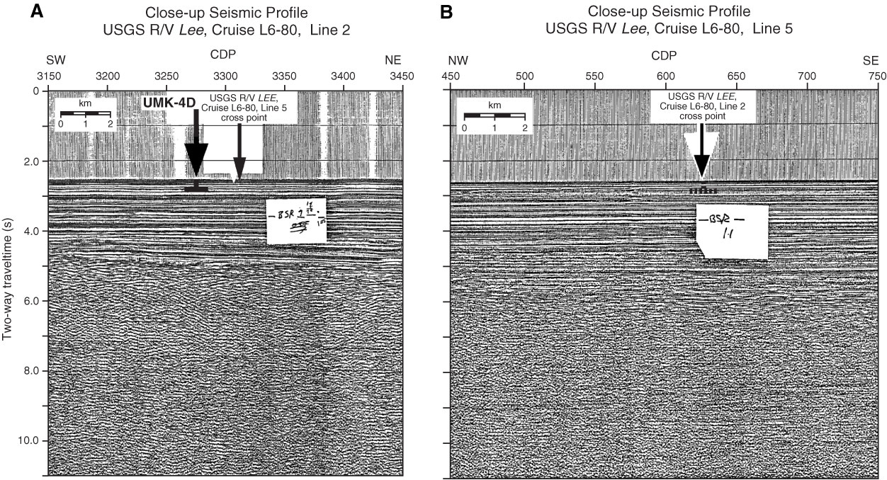
Figure AF53. A. Close-up seismic profile of USGS Lee Cruise L6-80 Line 2 across Site UMK-4D (169°58.9´W, 54°40.2´N; Shotpoint 3275; water depth = 1900 m; penetration depth = 200 m). B. Close-up seismic profile of USGS Lee Cruise L6-80 Line 5 near Site UMK-4D. Penetration depth is projected from the southwest on the cross point with Line 2 (Shot point 625; see Fig. AF55). Profiles are digitized from paper-form profiles at the SSDB. Stickied notation of the BSR was on the paper-form profile before digitization. CDP = common depth point.
Previous | Close | Next | Top of page