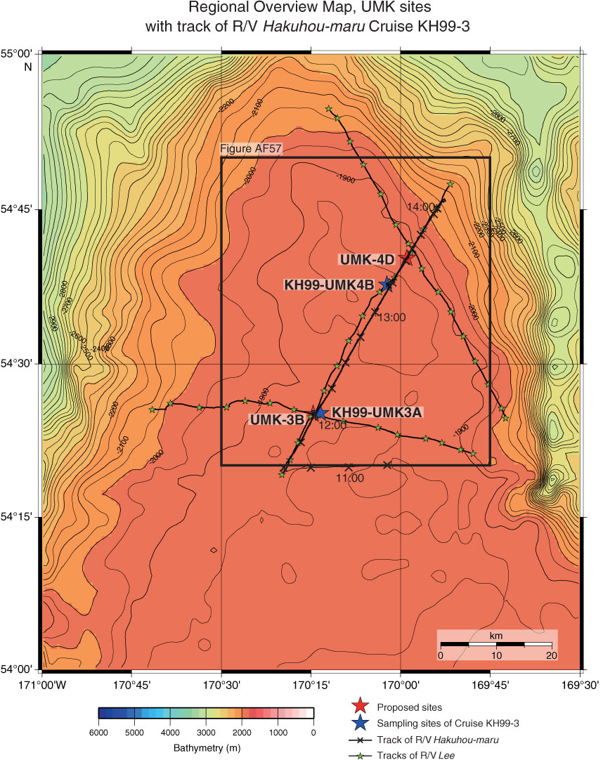
Figure AF55. Track chart of Hakuhou-maru Cruise KH99-3 Leg 3 around Sites UMK-4D (169°58.9´W, 54°40.2´N; water depth = 1900 m) and UMK-3B (170°14.6´W, 54°25.1´N; water depth = 1898 m), marked by red stars. Blue stars = sampling points of Cruise KH99-3 and are not same locations as sites. Square = area of swath bathymetry in Figure AF57. Bathymetric image and contour line created by GMT (gmt.soest.hawaii.edu) using GINA Global Topo Data (www.gina.alaska.edu).
Previous | Close | Next | Top of page