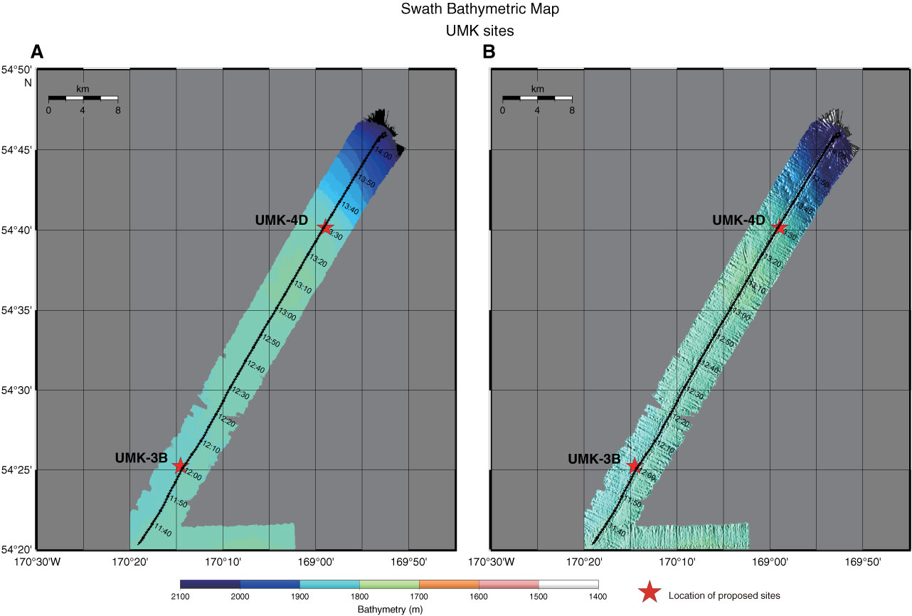
Figure AF57. Swath bathymetric map with track chart at time of Hakuhou-maru Cruise KH99-3 around Sites UMK-4D (169°58.9´W, 54°40.2´N; water depth = 1900 m) and UMK-3B (170°14.6´W, 54°25.1´N; water depth = 1898 m). A. Plain image. B. Shaded relief image.
Previous | Close | Next | Top of page