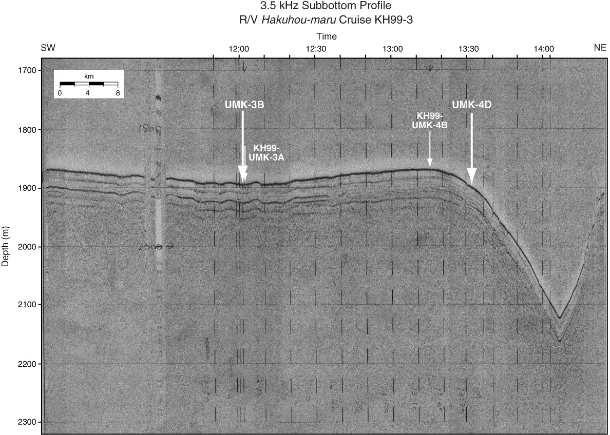
Figure AF56. 3.5 kHz subbottom profile survey from Hakuhou-maru Cruise KH99-3 around Sites UMK-4D (169°58.9´W, 54°40.2´N; water depth = 1900 m) and UMK-3B (170°14.6´W, 54°25.1´N; water depth = 1898 m). Sites (bold arrow) and sampling points in Cruise KH99-3 (thin arrow; KH99-UMK-4B and KH99-UMK-3A) are indicated. Horizontal axis of ship time corresponds to time annotation in swath bathymetric map.
Previous | Close | Next | Top of page