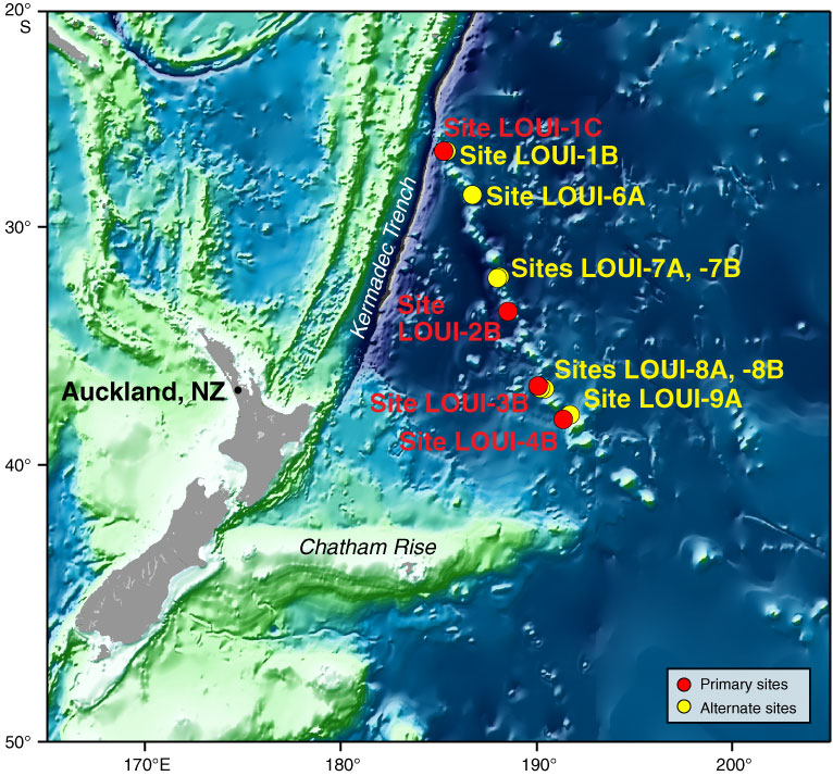
Figure F1. Bathymetric map of the Southwest Pacific showing the prominent Louisville Seamount Trail and the location of planned primary and alternate dredge sites. This GMT-generated map uses GEBCO 1-min data (Mercator projection).
Close | Next | Top of page