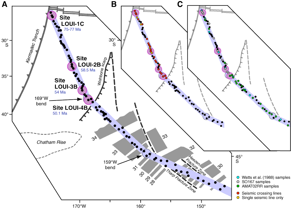
Figure F2. A. Louisville Seamount Trail with its narrow 75 km wide chain of guyots and seamounts. The four proposed primary drill sites are indicated by pink circles. B. AMAT02RR multichannel seismic coverage distinguishing between guyots with crossing lines and guyots with single seismic lines. C. Available samples from the SO167 and AMAT02RR site survey dredges. Note that preliminary results and data from both site surveys are included in diagrams in the following figures.
Previous | Close | Next | Top of page