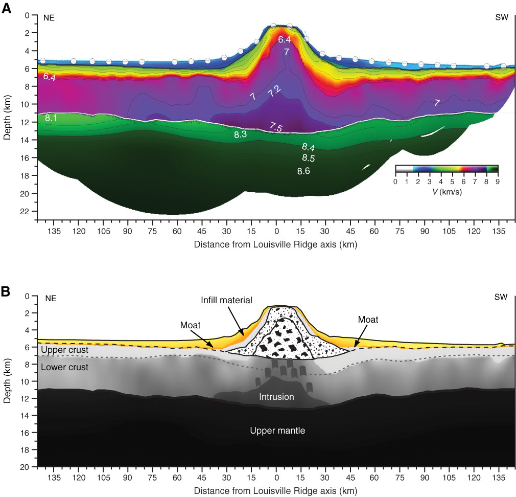
Figure F7. A. Velocity model obtained from topographic inversion of traveltimes from crustal and mantle phases along a single 370 km long seismic refraction line conducted orthogonally to the overall northwest trend of the Louisville Seamount Trail and crossing the summit of the 27.6°S guyot (~1.1° south of proposed Site LOUI-1C) during the German SO195 cruise (Grevemeyer and Flüh, 2008). B. Geologic interpretation revealing some internal seamount structures based on seismic velocity values: 1.5–4.0 km/s for volcaniclastic and mass wasting deposits; 7.2–7.6 km/s for intracrustal magma intrusion; 8.0 km/s for the upper mantle; 5.0–6.4 km/s for the extrusive volcano; and 6.4–7.0 km/s for the intrusive core. Assumed upper and lower crustal velocity ranges are 4.0–6.4 km/s and 6.4–7.2 km/s, respectively. The infill material is likely the volcaniclastic sequence directly underlying the pelagic cap that is thickening toward the edge of the guyot shelves, as seen on the AMAT02RR multichannel seismic reflection data. Both cross sections after Contreras-Reyes et al. (2010).
Previous | Close | Next | Top of page