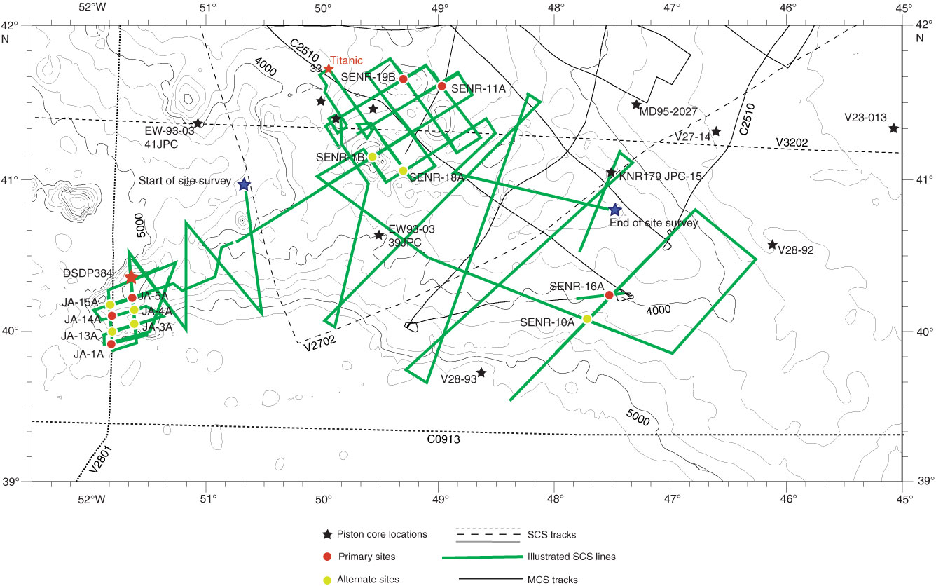
Figure F4. Track map for the Newfoundland ridges. Green lines are single-channel seismic (SCS) lines collected during R/V Knorr site survey Cruise 179-1. Additional seismic profiles (gray lines) that support Expedition 342 drilling are shown. Also shown is Deep Sea Drilling Project (DSDP) Site 384, which provides stratigraphic control for interpretation of the seismic data set. MCS = multichannel seismic.
Previous | Close | Next | Top of page