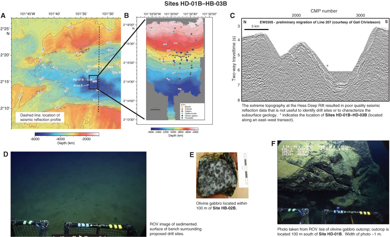
Figure AF1 Summary of site survey data used to select primary proposed Sites HD-01B–HD-03B. A. Regional contoured bathymetric map of the Hess Deep Rift with locations of primary and alternate proposed sites and ODP Sites 894 and 895. Contour intervals = 100 m. Black box identifies the area enlarged in B; dashed north–south line indicates the location of the seismic reflection profile shown in C. B. Contoured microbathymetry map with locations of primary proposed drill sites and the distribution of rock types recovered by the ROV Isis. Contour interval = 20 m. C. North–south trending multichannel seismic reflection across the Hess Deep Rift. Line HD207 was collected during Cruise EW0305 on board the R/V Ewing in 2003 (G. Christensen, unpubl. data). The poor quality of the profile caused by the extreme topography at the Hess Deep Rift, therefore these data were not used to select the primary drill sites. D. Seafloor image of the sedimented bench on which proposed Sites HD-01B–HD-03B are located. E. Photo of a hand specimen of olivine gabbro collected from within 100 m of proposed Site HD-02B. F. Seafloor photo of an olivine gabbro outcrop located 100 m south of proposed Site HD-01B. Width of photo = ~1 m.
Close | Next | Top of page