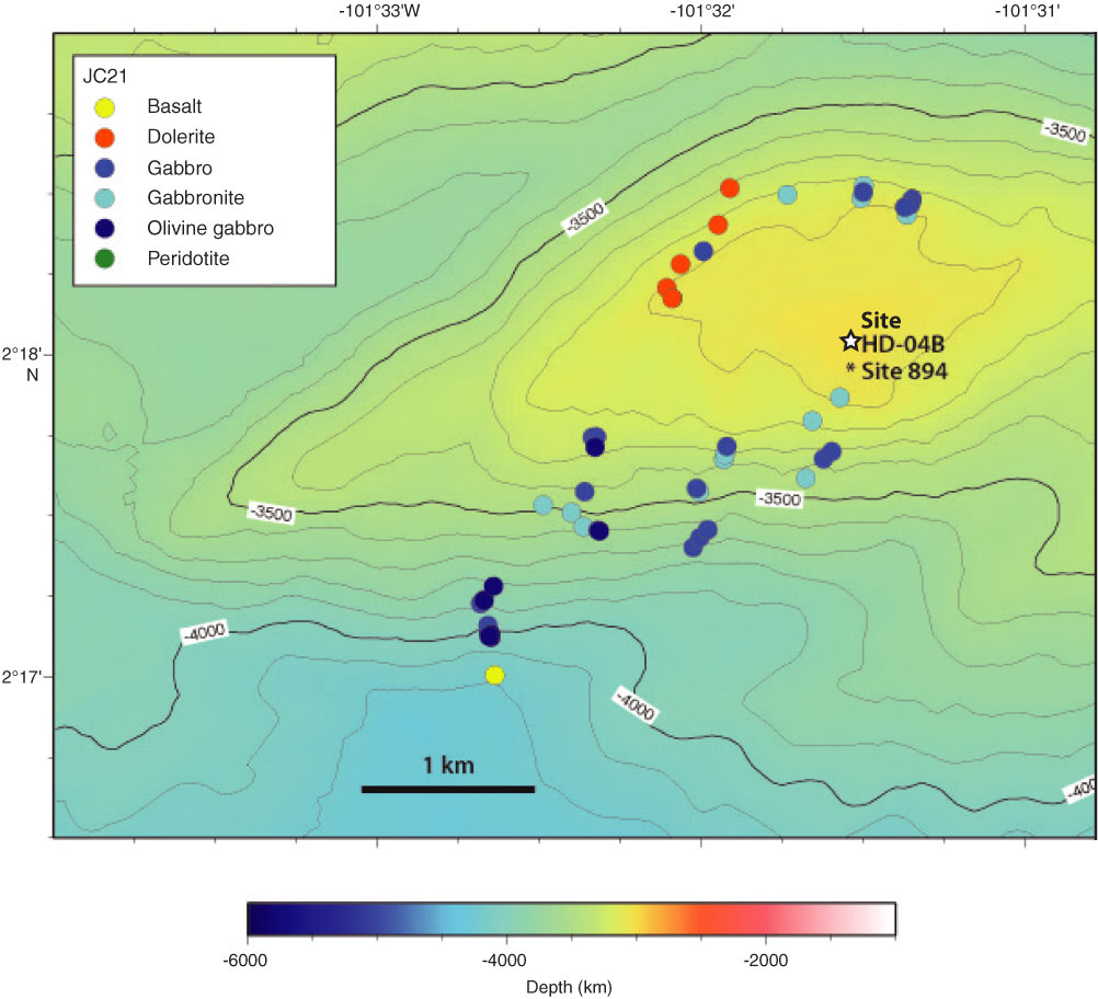
Figure F6. Contoured bathymetry map for the summit of the intrarift ridge showing the location of proposed drill site and the location and rock type for samples recovered by the ROV Isis. Rock types were determined by shore-based petrographic analysis (C. MacLeod, unpubl. data, 2009). Contour interval is 20 m. See Figure F4 for location. Map prepared by D. Shillington and V. Ferrini.
Previous | Close | Next | Top of page