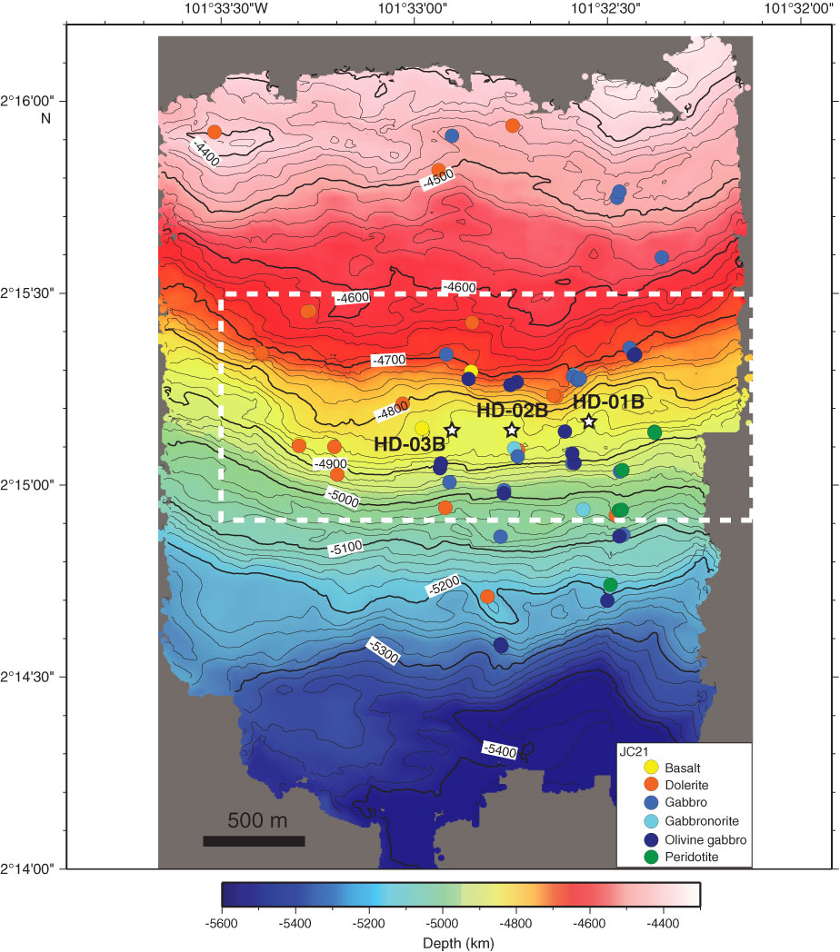
Figure F5. Contoured, microbathymetry map for southern slope between 4300 and 5400 mbsl showing the location of proposed Sites HD-01B–HD-03B and the location and rock type for samples recovered by the ROV Isis (MacLeod et al., unpubl. cruise report, 2008). Rock types were determined by shore-based petrographic analysis (C. MacLeod, unpubl. data, 2009). Microbathymetry data were acquired at a nominal altitude of ~100 m and speed of 0.3 kt by a Simrad SM2000 (200 kHz) multibeam sonar system mounted on the Isis. Swath widths during Isis surveys were ~200–350 m depending on noise and seabed characteristics (dip and reflectivity). See Figure F4 for location within the Hess Deep Rift. Detailed bathymetry and geology of the sedimented bench in the vicinity of the drill sites outlined by the dashed line is shown in Figure F8. Note that the NazCoPac samples are not shown because their locations are not precisely known. Map prepared by D. Shillington and V. Ferrini.
Previous | Close | Next | Top of page