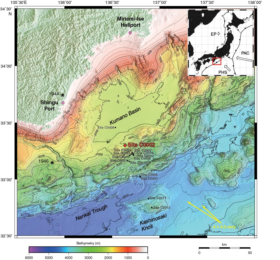
Figure F1. Map of NanTroSEIZE region, showing all Stage 1, 2, and 3 drilling sites. Diamond = Expedition 348 site, circles = Stage 1, 2 and 3 sites, black stars = 1944 and 1946 earthquake epicenters, yellow arrows = range estimates of plate motion vector between Philippine Sea plate (PHS) and Eurasian plate (EP). PAC = Pacific plate.
Close | Next | Top of page