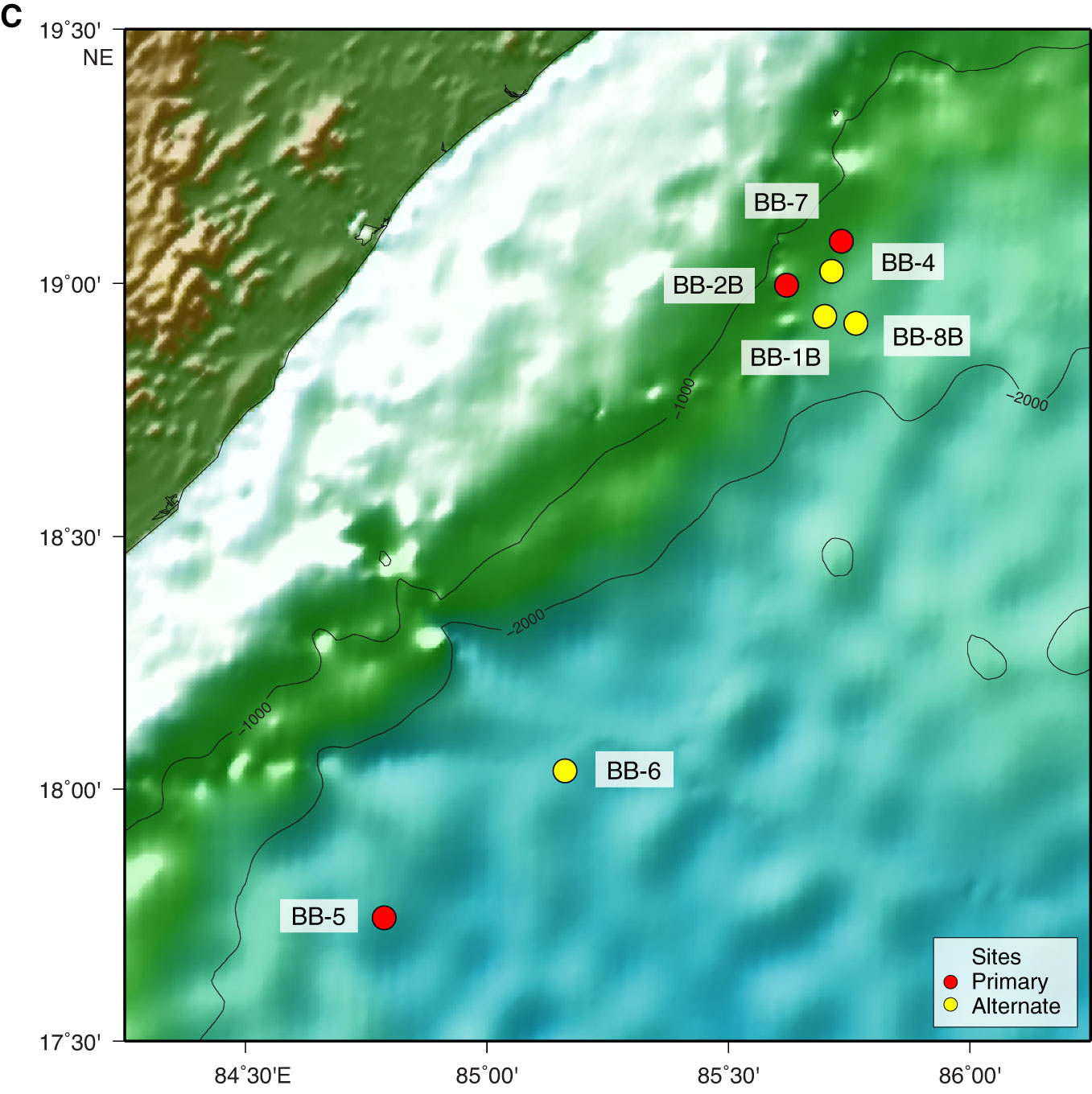
Figure F1 (continued). C. Location of the Mahanadi Basin sites. Map was generated using the Generic Mapping Tools (GMT 4.5.8; gmt.soest.hawaii.edu/) and the bathymetric GEBCO_08 Grid (version 20100927; www.gebco.net/). (Continued on next page.)
Previous | Close | Next | Top of page