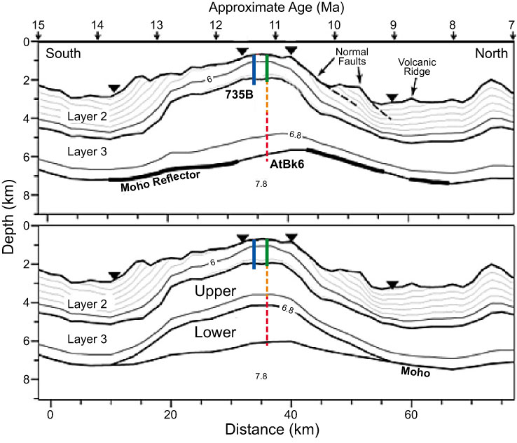
Figure F5. Velocity models for north–south seismic Line CAM101 over Atlantis Bank, together with principal proposed drill sites, modified after Muller et al. (2000). Green line = target depth of proposed Site AtBk6 drilled during Expedition 360, orange line = projected penetration during SloMo-Leg 2, red line = projected penetration during SloMo-Leg 2 (riser drilling). Velocity contours are 0.4 km/s. Upper panel shows an undifferentiated Layer 3; lower panel shows a lower serpentinized mantle Layer 3 and an upper gabbroic Layer 3. The models fit the data equally well. Triangles mark ocean-bottom hydrophones. Proposed Site AtBk6 lies on the line, and Hole 735B is projected from a kilometer to the west. Moho gaps are due to ocean bottom seismometer placement and are not real.
Previous | Close | Next | Top of page