Next Section | Table of Contents
doi:10.2204/iodp.sp.nantroseize1.2006
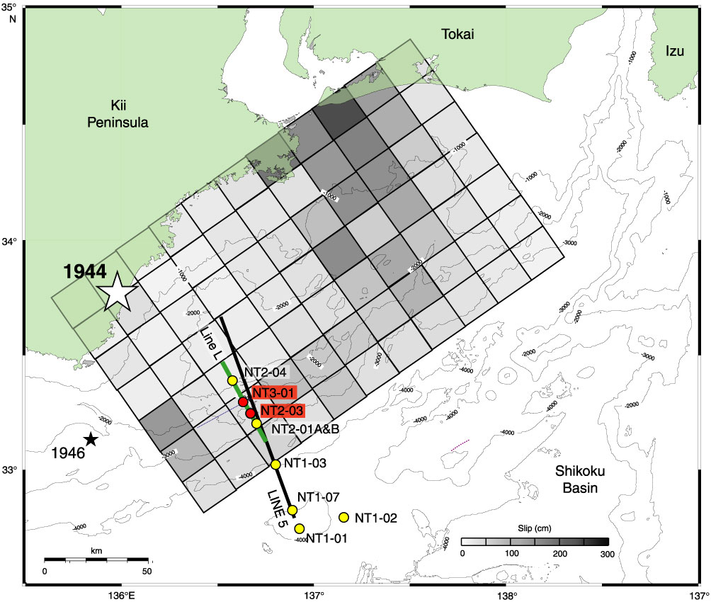
Figure F1 (continued). B. Coseismic slip (B) and (C) tsunami source inversions of the 1944 Tonankai earthquake by Ichinose et al., (2003) and Baba and Cummins (2005), respectively. Both maps show that the coseismic displacement had a large component of shallow slip (seismic asperity) updip of the nucleation region. The NanTroSEIZE drilling transect targets this apparent asperity region. The shallow high-slip zone corresponds to the location of the megasplay fault (see Fig. F3), suggesting that it may have been the locus of coseismic slip. Stars indicate epicentral location of great earthquakes. Gray shaded boxes = spatial distribution of slip in centimeters during the 1944 Tonankai earthquake. Red = planned riser drilling sites, yellow = riserless only sites. (Continued on next page.)