Next Section | Table of Contents
doi:10.2204/iodp.sp.nantroseize1.2006
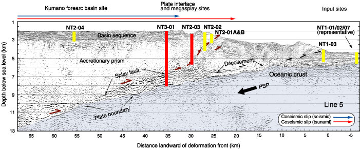
Figure F3. Prestack depth-migrated seismic line of Park et al. (2002), with locations of planned drill sites. Red and blue arrows = seaward extent of co-seismic slip inferred from tsunami and seismic data, respectively. Location of seismic profile is shown in Figures F1B and F2. Vertical exaggeration = 2X. PSP = Philippine Sea plate. Red line shows planned riser boreholes.
