Next Section | Table of Contents
doi:10.2204/iodp.sp.nantroseize1.2006
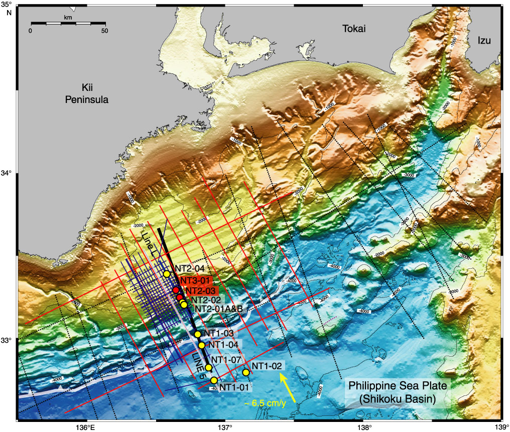
Figure F2. Bathymetric map of Kumano Basin region, with all multichannel seismic (MCS) profile locations and planned drill sites located. White barbed line = position of deformation front of accretionary prism. Portions of Line L (bold blue), Line 5 (bold black), and Line KR9806-2 (white dashed) are shown in Figures F3, F5, F6, and F7. Proposed Site NT1-02 is an alternate for Site NT1-07. Yellow = convergence vector between Philippine Sea plate and Japanese Islands (Eurasian plate). Red = planned riser drilling sites, yellow = riserless sites.