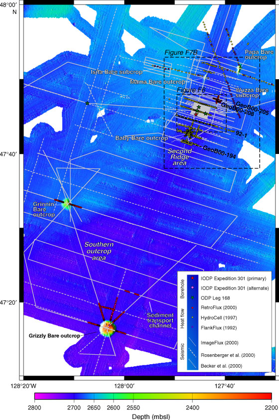
Figure F3. Swath map of Second Ridge and Southern outcrop area, showing distribution of heat flow data and track lines. Detailed track chart of Second Ridge area is shown in Figure F6. Note that seafloor in Second Ridge area is actually slightly deeper (darker blue) than that of the surrounding area and that the seafloor deepens to the south, in the direction of Grizzly Bare outcrop (purple). Also note sediment transport channel to the east of Grizzly Bare outcrop (see "Supplementary Material" for the high-resolution version of this figure in its native format).