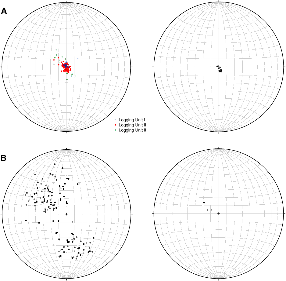
Figure F29. Equal area lower hemisphere stereographic projection of poles to bedding planes in (A) the forearc basin, logging Units I (0–136 m LWD depth below seafloor [LSF]), II (136–830 m LSF), and III (830–936 m LSF) and (B) the prism, logging Unit IV (936–1400 m LSF). Left panel data identified in borehole images; right panel data determined from 3-D seismic data (Table T6).
Previous | Close | Next | Top of page