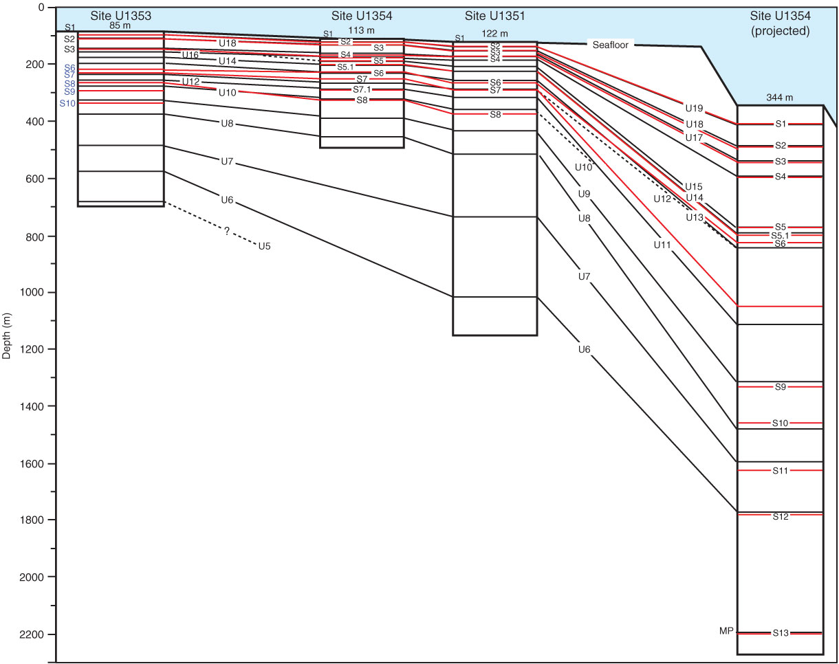
Figure F19. The Expedition 317 drilling transect across the shelf and upper slope of the Canterbury Basin permits correlation of lithology to seismic sequence boundaries. Lithologic contacts and their overlying associated facies were documented, and preliminary correlations were made to the predicted depths of seismic sequence boundaries. At Sites U1352 and U1354, at which recovery was high, there is good correlation between the sedimentary and seismic records, particularly above U10. The figure illustrates the depths of lithologic contacts at each site (e.g., inner shelf, U1351-S1 [99 m]). U19–U5 are shown schematically, intersecting each site at their predicted depths. Future shore-based studies will expand on these initial results. For further details about lithologic surfaces, see Tables T4 in the "Site U1351" chapter, T4 in the "Site U1352" chapter, T2 in the "Site U1353" chapter, and T3 in the "Site U1354" chapter. Black lines = seismic sequence boundaries, red lines = lithologic boundaries. Contacts shown in blue are uncertain because of poor recovery. MP = Marshall Paraconformity.
Previous | Close | Next | Top of page