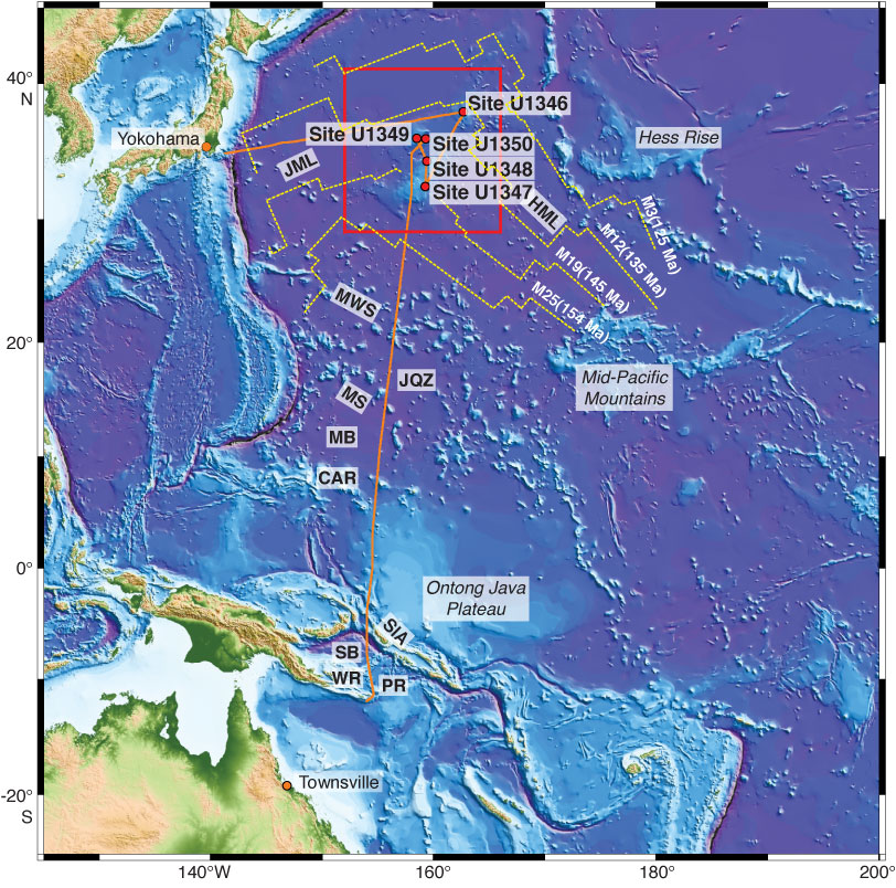
Figure F5. Geophysical track lines collected during Expedition 324. Topography was made using the 30 arc-s resolution GEBCO_08 grid (General Bathymetric Chart of the Oceans, 2008). Red circles = Expedition 324 drill sites, yellow dashed lines = Hawaiian and Japanese magnetic lineations (Nakanishi et al., 1999). CAR = Caroline Islands, HML = Hawaiian magnetic lineations, JQZ = Jurassic Quiet Zone, JML = Japanese magnetic lineations, MB = Mariana Basin, MS = Magellan Seamounts, MWS = Marcus-Wake Seamounts, PR = Pocklington Ridge, SB = Solomon Basin, SIA = Solomon Islands arc, WR = Woodlark Ridge.
Previous | Close | Next | Top of page