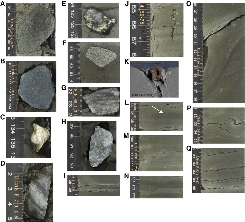
Figure F10. Lonestones and sedimentary and deformational structures, Site U1418. A. Sandstone (interval 341-U1418F-23R-3A, 81–87 cm). B. Siltstone (interval 341-U1418D-17H-3A, 109–114 cm). C. Limestone (interval 341-U1418F-6R-4A, 133–136 cm). D. Banded chert (interval 341-U1418F-7R-1A, 2–5 cm). E. Gabbro (interval 341-U1418A-31H-1A, 124–127 cm). F. Granite (interval 341-U1418F-46R-2A, 58–60 cm). G. Gneiss (interval 341-U1418F-38R-1A, 22–24 cm). H. Quartzite (interval 341-U1418B-2H-4A, 89–93 cm). I. Calcite-cemented mud lamina located between 25.3 and 26.0 cm (interval 341-U1418F-40R-1A, 24–26 cm). J, K. Pyritized burrows; (J) interval 341-U1418F-22R-4A, 65–68 cm, (K) interval 341-U1418F-35R-2A, 23–25 cm. L. Cross-stratification (arrow) (interval 341-U1418F-50R-1A, 133–136 cm). M. Erosional unconformity (interval 341-U1418F-52R-4A, 108–112 cm). N. Normal fault (interval 341-U1418F-39R-2A, 131–133 cm). O. Soft-sediment deformation (interval 341-U1418F-50R-2A, 26–38 cm). P. Unconformity at base of slump (interval 341-U1418F-50R-3A, 31–35 cm). Q. Normal faults (interval 341-U1418F-50R-1A, 80–85 cm).
Previous | Close | Next | Top of page