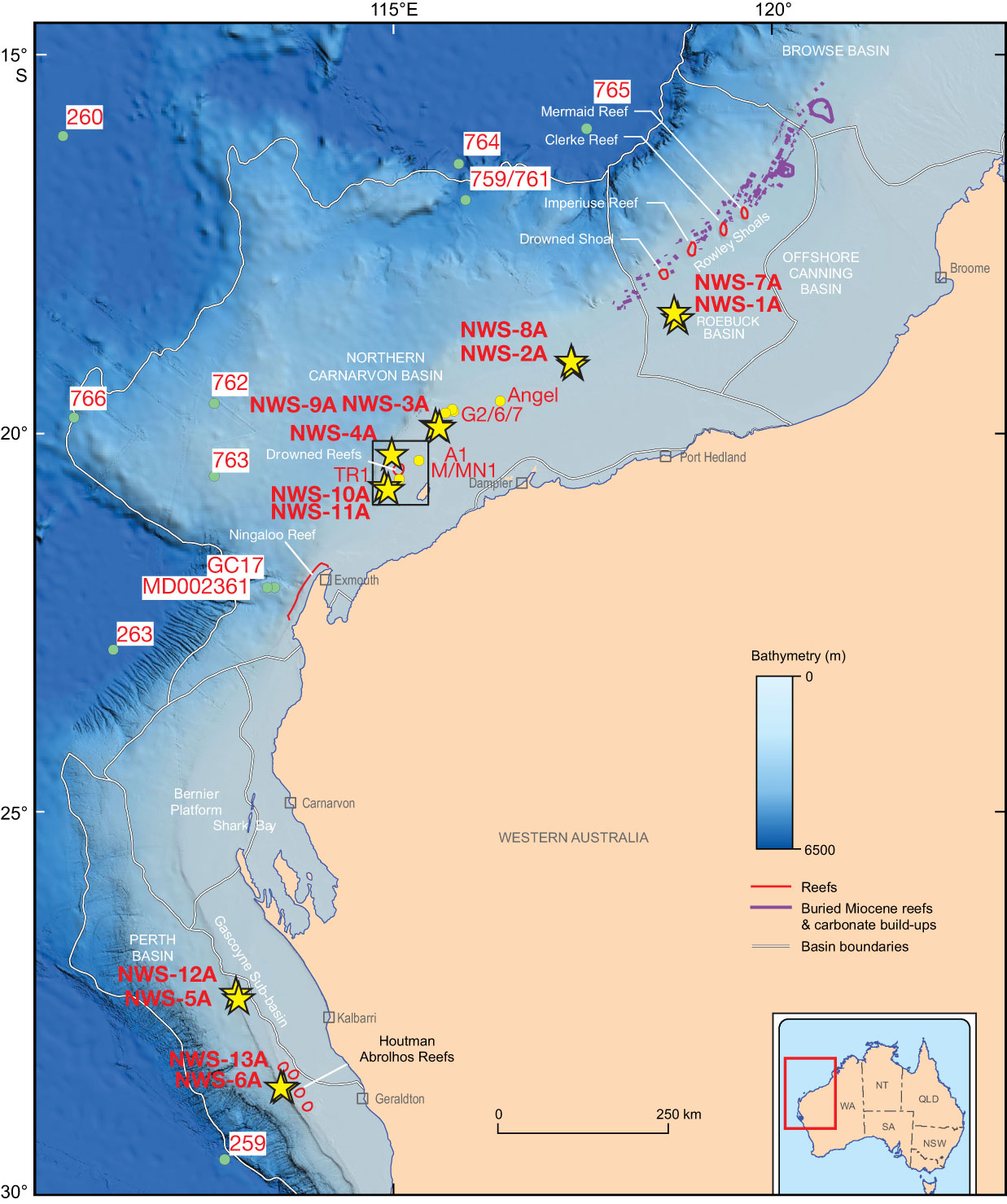
Figure F1. Map of the NWS showing major basins and location of modern and “fossil” reefs. Seismic data near Site NWS-4A is shown on Figure F7. Stars = primary and alternate sites, green circles = DSDP/ODP sites and other core locations referred to in text, yellow circles = industry well locations (Angel = Angel-1, G2/6/7 = Goodwyn-2, Goodwyn-6, Goodwyn-7, A1 = Austin-1, M/MN1 = Maitland/Maitland North-1, TR1 = West Tryal Rocks-1. WA = Western Australia, NT = Northern Territory, SA = South Australia, QLD = Queensland, NSW = New South Wales.
Close | Next | Top of page