Next Section | Table of Contents
doi:10.2204/iodp.sp.nantroseize1.2006
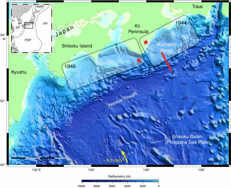
Figure F1. A. Nankai Trough region of southwestern Japan is the locus of subduction of the Philippine Sea plate (PSP) beneath Honshu and Shikoku islands. Shaded boxes are the generalized slip areas of the last two great subduction earthquakes (stars represent epicenter locations for earthquake nucleation). Red line shows the location of seismic reflection Line 5, portions of which are shown in Figures F3, F4, and F5. Arrow shows convergence direction of PSP and Japan. Inset shows location of Nankai Trough. EP = Eurasian plate, PP = Pacific plate, NAP = North American plate. (Continued on next two pages.)
